

IT WAS the last week of September, and a drizzle continued intermittently throughout the day. The calm waters of the Indus crossed beneath the Thatta-Sujawal bridge — the last structure over the Indus river system in the deltaic region, before it meets the Arabian Sea.
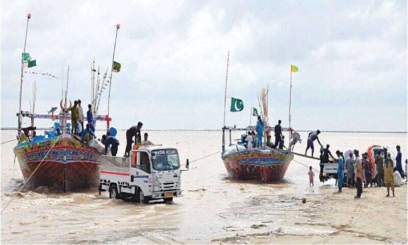
A group of fishermen had just anchored their vessel near the right bank of the Indus at the Dando jetty, after a week-long fishing trip at sea. They had their catch on ice, ready for onward transport to Karachi.
“Freshwater from the river is entering the sea. I believe river flows lead to growth in fish when freshwater meets the sea for a few months,” said Mohammad Khan Katyar, who sends his fresh catch to Karachi.
The peak of the monsoon floods had passed the last big barrage on the Indus — Kotri.
For those whose livelihoods are tied to the Indus delta, the recent monsoon floods were a boon, not a bane
“Floods are blessings of God for us as they repulse intruding sea”, remarked 68-year-old Haji Ahmed Murgur, a Keti Bander resident who remembers area from its heyday, before the sea began to encroach on the ecosystem here.
Sindh’s coastal belt faces never-ending seawater intrusion, which is rendering subsoil water brackish at a rapid pace. The taluka has 31 Dehs, spread over 124,000 acres. But just over half of this area is now under water, according to the Thatta deputy commissioner.
Besides Keti Bander, Kharochan is another small city that has almost been devoured by the sea, leading to large-scale migration from the area over the last several years.
After Thatta’s bifurcation, Kharochan now falls in Sujawal district, whose incumbent DC Zahid Rind told us that out of 32 Dehs, 29 have been swallowed by the Arabian Sea.
“The three Dehs that are left are fighting for their survival,” Rind said.
Thanks to the monsoon floods, the Indus has been taking freshwater flows to its delta for over three months now. These are entering the sea through one of the active creeks — Khobar, around Keti Bander.
“It is an hour’s boat ride to Khobar creek, and then another hour or so to reach the Arabian Sea,” said Moor Mallah, a young fisherman.
“You can see Kharochan city from here,” said Moor Mallah. Standing on the jetty of Keti Bander, he pointed towards a plantation on the other side of the river. Behind those mangroves, lies Kharochan, in the shape of an island.
The Pakistan Council of Research in Water Resources (PCRWR) has been involved with a study titled ‘Monitoring Sea Water Intrusion, Sea Level Rise, Coastal Erosion and Land Subsidence along Sindh and Balochistan Coast’ to monitor water quality in the coastal areas.
The study is being led by the National Institute of Oceanography (NIO), in collaboration with Suparco, the Pakistan Navy and PCRWR.
According to PCRWR expert Ghulam Murtaza Arain, “as far as the water quality component is concerned, we have found saline/seawater intrusion up to 135-140 km from the southern coastline towards Kotri during testing.”
He explained that the same value of intrusion was found around 45-90 km from the southwest coastline towards Kotri.
“This study revealed that seawater intrusion intensifies with depth and is more widespread below 100 meters,” he said.
Besides Khobar, Khar was another active creek, according to research on seawater intrusion covering the period 1972-2017 by Dr Altaf Siyal, the acting vice chancellor of Sindh Agriculture University (SAU).
The research indicated that the shoreline has moved landward on the Indus’ left bank (currently Sujawal) more than on its right bank (Thatta). He had divided the right and left bank sides into four shoreline zones.
The research showed that in zones I and II on the left side of the Indus, the shoreline has moved landward by approximately 1 km and 1.24, km respectively. On the Indus’s right, the sea has intruded by 0.68 km and 0.4 km in zones III and IV, respectively.
“This substantial landward movement of the shoreline in Sujawal district is due to flat land there and coastal wave energy, strong south-westerly winds energy, supplementing fast erosion of land by increasing the pace of waves,” said Prof. Siyal, whose findings showed that the rate of shoreline change was noticeably more between 1990-2017 than the 1972-1990 period in Sujawal. Thatta also reports similar changes in its shoreline.
Until October 6, the flows downstream of Kotri Barrage had dropped to 84,000 cusecs and would continue to drop as winter approaches. The situation will remain discouraging for those dependent on river flows until May and June next year.
“The NIO study proved that land subsidence is quite clear in the Indus delta. But it is not limited to the delta, and has been reported from Pasni and Makran in Balochistan, and even in Karachi,” according to one expert associated with the study, which has been shared with the Senate’s Standing Committee on Science and Technology.
The land subsidence phenomenon was not investigated in Sindh and Balochistan, and this is the first time it is being studied, he said.
According to his observations, land subsidence was mostly being found in tail-end areas of the Indus delta, i.e., areas like upstream Kharochan, Daboo Creek, etc.
It is caused by the extraction of groundwater and hydrocarbons, and due to the movement of micro-tectonic plates, he explained, adding that when groundwater extraction is carried out on a massive scale, a vacuum is created and the area becomes prone to land subsidence, making it easily prone to erosion.
A large portion of the coastal region is subsiding, with some areas dropping by several centimetres. The most critical subsidence, he said, was observed south of Dabbo Creek, with negative vertical displacement ranging from -178 mm to -332.6 mm, the report stated. This makes such areas more vulnerable to flooding, sea level rise, and coastal hazards.
Published in Dawn, October 15th, 2025